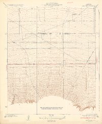
1933 Map of Hayes Ranch
USGS Topo · Published 1933About this map
The Hayes Ranch area of Kern County is depicted here during the early 1930s, at a unique surveying intersection where the Mt Diablo Base and Meridian meets the San Bernardino Base and Meridian. This convergence point highlights the complex administrative history of California land division. The landscape is defined by the alluvial fans and drainage patterns of Muddy Creek, which flows northward from the foothills toward the basin floor. Human activity is concentrated along the Maricopa State Highway and the intersecting San Emigdio Road, tracing the path of early automotive travel through the valley. A lone Cem label indicates a small burial ground, providing a crucial point of interest for genealogists researching family-owned ranch land and early rural life in the southern San Joaquin Valley.
Find a feature on this map
7 named features on this map. Tap any name to fly to it.
Don’t see what you’re looking for? This feature index may not catch every label — zoom into the map to look around manually.
Map Details
Editions of this 1933 Hayes Ranch Map
3 editions found
Other maps of this area

1903 · Mt. Pinos
USGS Topo · 1:125,000

1910 · Buena Vista Lake
USGS Topo · 1:125,000

1912 · Buena Vista Lake
USGS Topo · 1:125,000

1929 · Mouth of Kern
USGS Topo · 1:31,680

1930 · Millux
USGS Topo · 1:31,680

1930 · Conner
USGS Topo · 1:31,680

1931 · Pentland Junction
USGS Topo · 1:31,680

1931 · Hayes Ranch
USGS Topo · 1:31,680

1932 · Mouth of Kern
USGS Topo · 1:31,680

1933 · Hayes Ranch
USGS Topo · 1:31,680