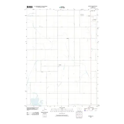
2010 Map of Hayfield
USGS Topo · Published 2010About this map
Eagle Lake and the surrounding agricultural lowlands of Hancock and Winnebago Counties anchor this 2010 topographic survey. The landscape is defined by the headwaters of the Iowa River, which splits into the West Branch Iowa River and the East Branch Iowa River. These waterways, alongside human-engineered features like Drainage Ditch Number 129, illustrate the intensive drainage efforts required to maintain the region's productive farmland. The area is dotted with small rural communities and historic crossroads, including the settlements of Hayfield, Madison, and Hawley.
Find a feature on this map
30 named features on this map. Tap any name to fly to it.
Don’t see what you’re looking for? This feature index may not catch every label — zoom into the map to look around manually.
Map Details
Editions of this 2010 Hayfield Map
This is the sole edition of this map. No revisions or reprints were ever made.
Other maps of this area

1954 · Mason City
USGS Topo · 1:250,000

1957 · Mason City
USGS Topo · 1:250,000

1958 · Mason City
USGS Topo · 1:250,000

1972 · Forest City
USGS Topo · 1:24,000

1972 · Hayfield
USGS Topo · 1:24,000

1972 · Crystal Lake
USGS Topo · 1:24,000

1972 · Pilot Knob
USGS Topo · 1:24,000
1972 · Thompson
USGS Topo · 1:24,000
1972 · Duncan
USGS Topo · 1:24,000
1972 · Miller
USGS Topo · 1:24,000