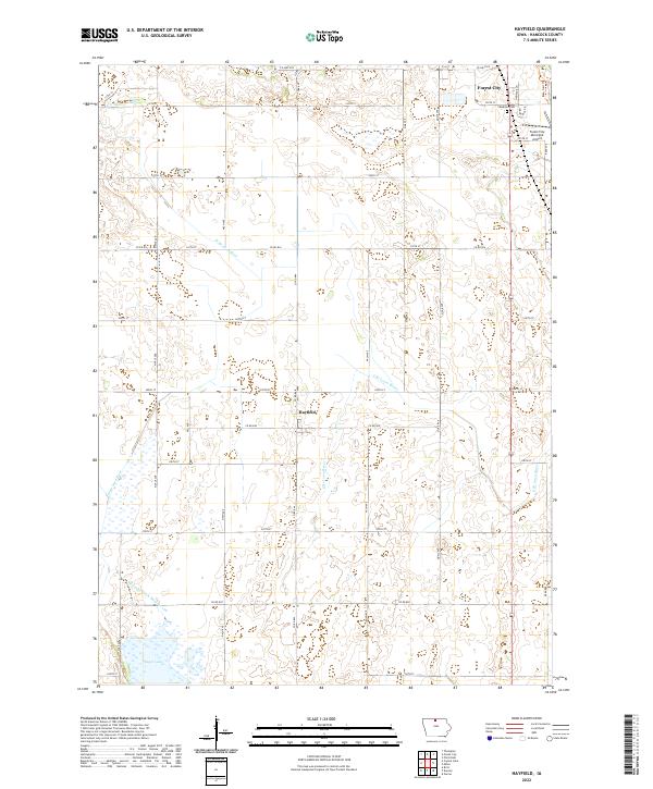
2022 Map of Hayfield
USGS Topo · Published 2022About this map
Hayfield and the southwestern edge of Forest City anchor this northern Iowa landscape, where the agricultural grid meets the winding headwaters of the Iowa River. The terrain is defined by the convergence of the W Br Iowa River and the E Br Iowa River, alongside significant water management features like Drainage Ditch Number 129. To the south, the wetland expanses surrounding Eagle Lake contrast with the highly ordered road network, which consists of numbered township roads and county routes such as Co HWY b14 and Co RD b16. Local landmarks include the Forest City Municipal Airport and the Madison Cem, providing specific points of interest for genealogists and local historians tracing the development of Hancock County. The map captures a contemporary snapshot of a region still deeply tied to its hydrology and rural infrastructure.
Find a feature on this map
27 named features on this map. Tap any name to fly to it.
Don’t see what you’re looking for? This feature index may not catch every label — zoom into the map to look around manually.
Map Details
Editions of this 2022 Hayfield Map
This is the sole edition of this map. No revisions or reprints were ever made.
Other maps of this area

1954 · Mason City
USGS Topo · 1:250,000

1957 · Mason City
USGS Topo · 1:250,000

1958 · Mason City
USGS Topo · 1:250,000

1972 · Forest City
USGS Topo · 1:24,000

1972 · Hayfield
USGS Topo · 1:24,000

1972 · Crystal Lake
USGS Topo · 1:24,000

1972 · Pilot Knob
USGS Topo · 1:24,000
1972 · Thompson
USGS Topo · 1:24,000
1972 · Duncan
USGS Topo · 1:24,000
1972 · Miller
USGS Topo · 1:24,000