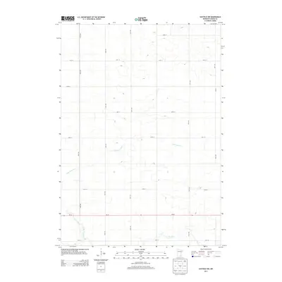
2013 Map of Hayfield NW
USGS Topo · Published 2013About this map
The Little Cedar River and Cedar River meander through this agricultural landscape in southern Minnesota during the early 21st century. The map reveals a highly structured rural grid, where family farms and homesteads are connected by a precise network of roads including 130th Ave and 180th Ave. The east-west corridor of Mn-30 serves as the primary artery for the region, cutting through the river valleys. This survey illustrates the modern drainage and land management patterns of Dodge County, showing how the local waterways influence the placement of thoroughfares like 740th St and Co Road J.
Find a feature on this map
15 named features on this map. Tap any name to fly to it.
Don’t see what you’re looking for? This feature index may not catch every label — zoom into the map to look around manually.
Map Details
Editions of this 2013 Hayfield NW Map
This is the sole edition of this map. No revisions or reprints were ever made.
Other maps of this area

1953 · Saint Paul
USGS Topo · 1:250,000

1954 · Mason City
USGS Topo · 1:250,000

1957 · Mason City
USGS Topo · 1:250,000

1958 · Mason City
USGS Topo · 1:250,000

1959 · Saint Paul
USGS Topo · 1:250,000

1962 · Owatonna SE
USGS Topo · 1:24,000

1965 · Dodge Center
USGS Topo · 1:24,000

1965 · Claremont
USGS Topo · 1:24,000

1966 · Waltham
USGS Topo · 1:24,000

1966 · Hayfield NW
USGS Topo · 1:24,000