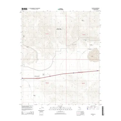
2015 Map of Hayfield
USGS Topo · Published 2015About this map
Joshua Tree National Park spans the northern portion of this Riverside County landscape, where the southern reaches of the Eagle Mountains meet the desert floor. The vital infrastructure of the Colorado River Aqueduct is a dominant feature, cutting across the terrain and disappearing into specialized engineering works like Hayfield Tunnel Number One and Hayfield Tunnel Number Two. This industrial corridor supports the settlement at Hayfield, positioned near the Julian Hinds Pump Plant Airstrip.
Find a feature on this map
24 named features on this map. Tap any name to fly to it.
Don’t see what you’re looking for? This feature index may not catch every label — zoom into the map to look around manually.
Map Details
Editions of this 2015 Hayfield Map
This is the sole edition of this map. No revisions or reprints were ever made.
Other maps of this area

1940 · Cottonwood Spring
USGS Topo · 1:62,500

1940 · Canyon Spring
USGS Topo · 1:62,500

1943 · Canyon Spring
USGS Topo · 1:62,500

1943 · Pinkham Well
USGS Topo · 1:62,500

1944 · Cottonwood Spring
USGS Topo · 1:62,500

1944 · Pinkham Well
USGS Topo · 1:62,500

1944 · Eagle Tank
USGS Topo · 1:62,500

1954 · Salton Sea
USGS Topo · 1:250,000

1955 · Salton Sea
USGS Topo · 1:250,000
1958 · Orocopia Canyon
USGS Topo · 1:24,000