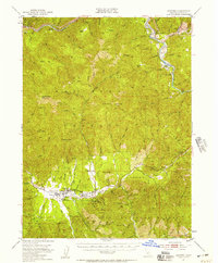
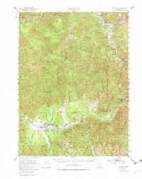
1951 Map of Hayfork
USGS Topo · Published 1957About this map
The Hayfork Valley serves as a vital agricultural and social hub for Trinity County during the early 1950s, centered around the settlement of Hayfork. This interior basin is defined by its timber and mining heritage, with a series of active and former extraction sites like the Kellogg Mine, Layman Mine, and Mueller Mine concentrated in the southern gulches. The community infrastructure of the era is clearly visible, featuring the County Fairground, a Ranger Station, and a Landing Field situated on the valley floor.
Find a feature on this map
104 named features on this map. Tap any name to fly to it.
Don’t see what you’re looking for? This feature index may not catch every label — zoom into the map to look around manually.
Map Details
Editions of this 1951 Hayfork Map
6 editions found

Other maps of this area

1890 · Red Bluff
USGS Topo · 1:250,000

1894 · Red Bluff
USGS Topo · 1:250,000

1909 · Big Bar
USGS Topo · 1:96,000

1913 · Weaverville
USGS Topo · 1:125,000

1915 · Big Bar and Vicinity
USGS Topo · 1:250,000

1918 · Anada
USGS Topo · 1:62,500

1931 · Hoaglin
USGS Topo · 1:96,000

1935 · Hoaglin
USGS Topo · 1:125,000

1950 · Minersville
USGS Topo · 1:62,500

1950 · Weaverville
USGS Topo · 1:62,500