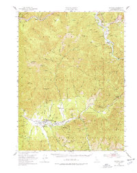
1951 Map of Hayfork
USGS Topo · Published 1977About this map
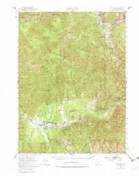
Hayfork Valley and the surrounding peaks of the Trinity National Forest dominate this mid-century survey. The settlement of Hayfork serves as the central hub, characterized by its Landing Field and the County Fairground. The map documents a rugged landscape defined by the winding Trinity River and the high vantage of Hayfork Bally Lookout. Extensive mining activity is evident throughout the southern reaches, with operations such as the Scorpion Mine, Layman Mine, and Cope & Johnson Mine scattered along the mountain gulches. Along the river to the north, smaller settlements like Big Bar and Junction City mark the transport corridor, while isolated outposts like Rose Ranch and Eagle Ranch illustrate the era's remote ranching and forest management patterns in northern California.
Find a feature on this map
70 named features on this map. Tap any name to fly to it.
Don’t see what you’re looking for? This feature index may not catch every label — zoom into the map to look around manually.
Map Details
Editions of this 1951 Hayfork Map
6 editions found

Other maps of this area

1890 · Red Bluff
USGS Topo · 1:250,000

1894 · Red Bluff
USGS Topo · 1:250,000

1909 · Big Bar
USGS Topo · 1:96,000

1913 · Weaverville
USGS Topo · 1:125,000

1915 · Big Bar and Vicinity
USGS Topo · 1:250,000

1918 · Anada
USGS Topo · 1:62,500

1931 · Hoaglin
USGS Topo · 1:96,000

1935 · Hoaglin
USGS Topo · 1:125,000

1950 · Minersville
USGS Topo · 1:62,500

1950 · Weaverville
USGS Topo · 1:62,500