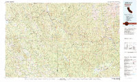
1982 Map of Hayfork
USGS Topo · Published 1983About this map
Hayfork and Hyampom serve as central points in this early 1980s look at the steep river drainages where Humboldt and Trinity counties meet. The landscape is defined by the deep canyons of the Trinity River and the South Fork Trinity River, showing a dispersed network of river settlements like Salyer, Hawkins Bar, and Big Bar linked by the winding route of highway 299. This era of the Trinity National Forest and Six Rivers National Forest shows the area's ongoing mining legacy through the location of the Yellowstone Mine and Coon & Johnson Mine in the eastern hills. The map captures the remote character of the Salmon Trinity Alps Primitive Area and the high ridges of South Fork Mountain before significant modern development, preserving the locations of regional landmarks like Hayfork Bally and the Ewing Reservoir.
Find a feature on this map
69 named features on this map. Tap any name to fly to it.
Don’t see what you’re looking for? This feature index may not catch every label — zoom into the map to look around manually.
Map Details
Editions of this 1982 Hayfork Map
This is the sole edition of this map. No revisions or reprints were ever made.
Other maps of this area

1886 · Shasta
USGS Topo · 1:250,000

1890 · Red Bluff
USGS Topo · 1:250,000

1894 · Red Bluff
USGS Topo · 1:250,000

1894 · Shasta
USGS Topo · 1:250,000

1909 · Big Bar
USGS Topo · 1:96,000

1913 · Weaverville
USGS Topo · 1:125,000

1914 · Pilot Creek
USGS Topo · 1:62,500

1915 · Big Bar and Vicinity
USGS Topo · 1:250,000

1918 · Anada
USGS Topo · 1:62,500

1919 · Glynn
USGS Topo · 1:62,500