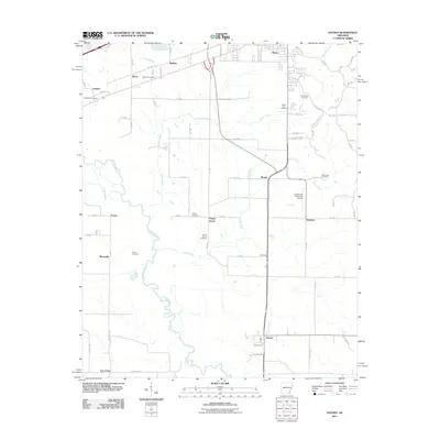
2011 Map of Haynes
USGS Topo · Published 2011About this map
The L'Anguille River meanders across the western landscape of this St. Francis County region, creating a winding riparian corridor that contrasts with the geometric grid of agricultural roads and drainage ditches like Candy Creek and Hinton Creek. The settlement of Haynes serves as a southern anchor, while smaller locales such as Poplar Grove, Bonair, and Elcana dot the interior. This map is particularly valuable for genealogists, as it preserves the locations of numerous family and community burial grounds, including Thomas Cemetery, Mount Vernon Cemetery, and Henderson Cemetery. Transportation and infrastructure are central to the area's layout, evidenced by the A W Siding rail feature and the Forrest City Municipal Airport situated near Heustess. The network of SFC and Lee County roads provides a detailed look at rural property access in the early 21st century.
Find a feature on this map
83 named features on this map. Tap any name to fly to it.
Don’t see what you’re looking for? This feature index may not catch every label — zoom into the map to look around manually.
Map Details
Editions of this 2011 Haynes Map
This is the sole edition of this map. No revisions or reprints were ever made.
Other maps of this area

1939 · Park Place
USGS Topo · 1:62,500

1939 · Wynne
USGS Topo · 1:62,500

1940 · Whitmore
USGS Topo · 1:62,500

1940 · Marianna
USGS Topo · 1:62,500

1948 · Helena
USGS Topo · 1:250,000

1950 · Helena
USGS Topo · 1:250,000

1953 · Memphis
USGS Topo · 1:250,000

1955 · Park Place
USGS Topo · 1:62,500

1955 · Helena
USGS Topo · 1:250,000

1956 · Memphis
USGS Topo · 1:250,000