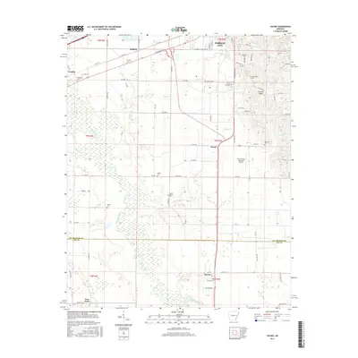
2017 Map of Haynes
USGS Topo · Published 2017About this map
Forrest City serves as the northern anchor for this study of the eastern Arkansas Delta, where the distinct elevation of Crowley Ridge rises above the alluvial plains. This geological formation creates a sharp contrast to the low-lying wetlands surrounding the L'Anguille River, which meanders through the western portion of the quadrangle. The settlement pattern follows this varied topography, with smaller communities like Haynes, Redfern, and Bonair positioned along the primary transport corridors. Numerous family and community landmarks are documented throughout the landscape, including Mount Vernon Cem, Elcana Cem, and Freedonia Cem. The southern reach of the survey crosses the boundary from St. Francis into Lee County, capturing the transition from the municipal surroundings of the Forrest City Municipal Airport to the more dispersed rural landscape of Four Forks.
Find a feature on this map
58 named features on this map. Tap any name to fly to it.
Don’t see what you’re looking for? This feature index may not catch every label — zoom into the map to look around manually.
Map Details
Editions of this 2017 Haynes Map
This is the sole edition of this map. No revisions or reprints were ever made.
Other maps of this area

1939 · Park Place
USGS Topo · 1:62,500

1939 · Wynne
USGS Topo · 1:62,500

1940 · Whitmore
USGS Topo · 1:62,500

1940 · Marianna
USGS Topo · 1:62,500

1948 · Helena
USGS Topo · 1:250,000

1950 · Helena
USGS Topo · 1:250,000

1953 · Memphis
USGS Topo · 1:250,000

1955 · Park Place
USGS Topo · 1:62,500

1955 · Helena
USGS Topo · 1:250,000

1956 · Memphis
USGS Topo · 1:250,000