2024 Map of Haynes
USGS Topo · Published 2024About this map
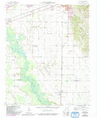
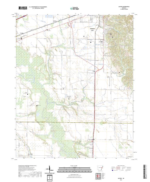
Forrest City anchors the northeastern corner of this landscape, where the southern reaches of Crowley's Ridge rise above the delta lowlands. The terrain transition is marked by numerous watercourses, including Hinton Creek, Candy Creek, and the meandering L'Anguille River in the south. This modern survey shows a rural environment defined by a dense grid of county roads and numerous small family or community burial sites. Genealogists will find many significant locations, such as Casteel Cem, Freedonia Cem, and El Cannon Community Cem, alongside the small settlements of Redfern, Bonair, and Haynes. The western portion of the map is particularly water-rich, featuring the Coffee Creek and Caney Creek drainages. Further south, the map identifies the crossroads at Four Forks and institutional landmarks like Mount Vernon Baptist Church, illustrating the dispersed but persistent settlement pattern typical of the St. Francis and Lee County borderlands.
Find a feature on this map
65 named features on this map. Tap any name to fly to it.
Don’t see what you’re looking for? This feature index may not catch every label — zoom into the map to look around manually.
Map Details
Editions of this 2024 Haynes Map
This is the sole edition of this map. No revisions or reprints were ever made.