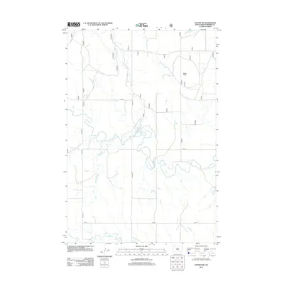
2012 Map of Haynes SW
USGS Topo · Published 2012About this map
N Fork Grand River meanders across this rural landscape in Perkins County, South Dakota, defining the drainage patterns and topography of the high plains. The terrain is punctuated by the prominent height of White Butte, which stands as a landmark overlooking the surrounding pastures. The water system is further detailed by Giles Cr and Lodgepole Cr, while Johnson Dam suggests the managed water resources essential for livestock and local agriculture in this semi-arid region. A grid of section-line roads, including Haynes Rd, 177th Ave, and 113th St, provide access across the vast open spaces, illustrating the persistent township and range surveying legacy that continues to organize the northern plains today.
Find a feature on this map
10 named features on this map. Tap any name to fly to it.
Don’t see what you’re looking for? This feature index may not catch every label — zoom into the map to look around manually.
Map Details
Editions of this 2012 Haynes SW Map
This is the sole edition of this map. No revisions or reprints were ever made.
Other maps of this area

1954 · Lemmon
USGS Topo · 1:250,000

1957 · Lemmon
USGS Topo · 1:250,000

1974 · White Butte
USGS Topo · 1:24,000

1974 · Kid Rich Butte
USGS Topo · 1:24,000

1974 · Haynes
USGS Topo · 1:24,000

1983 · Lodgepole SE
USGS Topo · 1:24,000

1983 · Haynes SE
USGS Topo · 1:24,000

1983 · Bison NE
USGS Topo · 1:24,000

1983 · Cole Dam
USGS Topo · 1:24,000

1983 · Bison NW
USGS Topo · 1:24,000