
1983 Map of Lodgepole SE
USGS Topo · Published 1984About this map
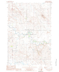
The Grand River National Grassland dominates this Perkins County landscape, which was documented during the late 1970s and early 1980s. The small settlement of Lodgepole serves as a local hub amidst a sprawling network of drainages, most notably Lodgepole Creek and the Grand River North Fork. The terrain is characterized by the distinct elevation of Castle Butte and various water resources essential for prairie life, including a prominently marked Well and the Vobejda Lake State Game Production Area. Boundary lines for Barrett and Lodgepole segments reflect the area's grazing and land management history. This provisional survey provides an exacting look at the hydrology of the Grand River system before subsequent changes in land use or nomenclature.
Find a feature on this map
12 named features on this map. Tap any name to fly to it.
Don’t see what you’re looking for? This feature index may not catch every label — zoom into the map to look around manually.
Map Details
Editions of this 1983 Lodgepole SE Map
This is the sole edition of this map. No revisions or reprints were ever made.
Other maps of this area

1954 · Lemmon
USGS Topo · 1:250,000

1957 · Lemmon
USGS Topo · 1:250,000

1974 · Hettinger South
USGS Topo · 1:24,000

1974 · Kid Rich Butte
USGS Topo · 1:24,000

1974 · Haynes
USGS Topo · 1:24,000

1983 · Cole Dam
USGS Topo · 1:24,000

1983 · Little Nasty Creek
USGS Topo · 1:24,000

1983 · Bison NW
USGS Topo · 1:24,000
1983 · Haynes SW
USGS Topo · 1:24,000
1983 · Lodgepole
USGS Topo · 1:24,000