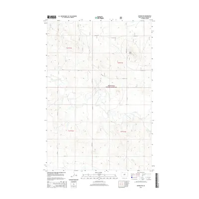
2015 Map of Haynes SW
USGS Topo · Published 2015About this map
Grand River National Grassland dominates this section of Perkins County, where the high plains are carved by the winding course of the North Fork Grand River. This 2015 survey illustrates a landscape primarily shaped by public grazing lands and a sparse network of section-line roads such as Pasture 5a Rd and 108th St. Notable landmarks like White Butte provide elevation in an otherwise rolling terrain of coulees and draws. The drainage of Giles Cr feeds into the main river system, supporting the local ranching economy and wildlife. Small-scale water management is evident at Johnson Dam, reflecting the critical importance of water conservation in the western Dakotas. The map provides a detailed view of township and range divisions, including t22n r13e and t21n r14e, which serve as the primary geographical markers for this rural expanse.
Find a feature on this map
14 named features on this map. Tap any name to fly to it.
Don’t see what you’re looking for? This feature index may not catch every label — zoom into the map to look around manually.
Map Details
Editions of this 2015 Haynes SW Map
This is the sole edition of this map. No revisions or reprints were ever made.
Other maps of this area

1954 · Lemmon
USGS Topo · 1:250,000

1957 · Lemmon
USGS Topo · 1:250,000

1974 · White Butte
USGS Topo · 1:24,000

1974 · Kid Rich Butte
USGS Topo · 1:24,000

1974 · Haynes
USGS Topo · 1:24,000

1983 · Lodgepole SE
USGS Topo · 1:24,000

1983 · Haynes SE
USGS Topo · 1:24,000

1983 · Bison NE
USGS Topo · 1:24,000

1983 · Cole Dam
USGS Topo · 1:24,000

1983 · Bison NW
USGS Topo · 1:24,000