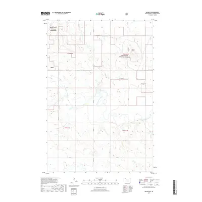
2017 Map of Haynes SW
USGS Topo · Published 2017About this map
Grand River National Grassland dominates this corner of Perkins County, where the sprawling plains are dissected by the meandering North Fork Grand River. The landscape is a study in Northern Great Plains topography, defined by drainage basins like Giles Cr and significant local elevations such as White Butte. While the area is largely characterized by open range and public land management, the infrastructure of rural life is visible through a grid of section-line roads including 110th St and Haynes Rd. Small-scale water management is evident at Johnson Dam, serving the agricultural needs of the high prairie. The map provides a precise look at the township and range boundaries that govern this part of South Dakota, reflecting the enduring legacy of the Public Land Survey System in a region where natural features and property lines are deeply intertwined.
Find a feature on this map
16 named features on this map. Tap any name to fly to it.
Don’t see what you’re looking for? This feature index may not catch every label — zoom into the map to look around manually.
Map Details
Editions of this 2017 Haynes SW Map
This is the sole edition of this map. No revisions or reprints were ever made.
Other maps of this area

1954 · Lemmon
USGS Topo · 1:250,000

1957 · Lemmon
USGS Topo · 1:250,000

1974 · White Butte
USGS Topo · 1:24,000

1974 · Kid Rich Butte
USGS Topo · 1:24,000

1974 · Haynes
USGS Topo · 1:24,000

1983 · Lodgepole SE
USGS Topo · 1:24,000

1983 · Haynes SE
USGS Topo · 1:24,000

1983 · Bison NE
USGS Topo · 1:24,000

1983 · Cole Dam
USGS Topo · 1:24,000

1983 · Bison NW
USGS Topo · 1:24,000