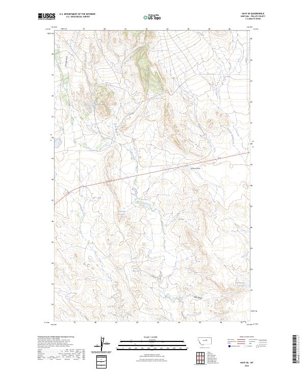
2024 Map of Hays SE
USGS Topo · Published 2024About this map
High plains drainage patterns and hydraulic management define this part of Phillips County, where the terrain is marked by a series of significant water impoundments and spring-fed features. The landscape is dominated by the seasonal flows of Warm Springs Creek and Rock Creek, which cut through the northern and western sections of the quadrangle. A notable localized water feature known as The Plunge suggests the area's unique hydrology, while the distribution of Pearl Reservoir, McChesney Reservoir, and Waydown Reservoir reflects the critical importance of water storage in this ranching environment. To the east, the Sand Hills and Kieth Coulee provide topographic relief against the surrounding gulches and creek beds. The road network remains sparse, centered on routes like 7 Mile Rd and Kelsey Rd, which provide access to the remote township boundaries of T24N R25E and its neighbors.
Find a feature on this map
24 named features on this map. Tap any name to fly to it.
Don’t see what you’re looking for? This feature index may not catch every label — zoom into the map to look around manually.
Map Details
Editions of this 2024 Hays SE Map
This is the sole edition of this map. No revisions or reprints were ever made.
Other maps of this area

1943 · Landusky
USGS Topo · 1:125,000

1954 · Bell Ridge East
USGS Topo · 1:24,000

1954 · Bell Ridge West
USGS Topo · 1:24,000

1954 · Lewistown
USGS Topo · 1:250,000

1959 · Lewistown
USGS Topo · 1:250,000

1971 · Bear Mountain
USGS Topo · 1:24,000

1971 · Hays
USGS Topo · 1:24,000

1971 · Robinson School
USGS Topo · 1:24,000

1971 · Hays SE
USGS Topo · 1:24,000
1971 · Zortman
USGS Topo · 1:24,000