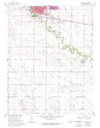
1961 Map of Hays South
USGS Topo · Published 1977About this map
Hays serves as the central hub of this 1961 survey, showing a period of significant growth south into the plains of Ellis County. The map details the transition from the concentrated urban core around the Courthouse and Hadley Hospital to the expanding campus of Fort Hays State College. South of the city, the meandering course of Big Creek defines the landscape, passing through Frontier Historical Park and the grounds of the Old Fort Hays Museum.
Find a feature on this map
27 named features on this map. Tap any name to fly to it.
Don’t see what you’re looking for? This feature index may not catch every label — zoom into the map to look around manually.
Map Details
Editions of this 1961 Hays South Map
3 editions found
Other maps of this area

1896 · Hays
USGS Topo · 1:125,000

1955 · Great Bend
USGS Topo · 1:250,000

1957 · Great Bend
USGS Topo · 1:250,000

1958 · Great Bend
USGS Topo · 1:250,000

1961 · Yocemento
USGS Topo · 1:24,000

1961 · Hays South
USGS Topo · 1:24,000

1961 · Catharine
USGS Topo · 1:24,000
1961 · Hays North
USGS Topo · 1:24,000

1961 · Antonino
USGS Topo · 1:24,000

1961 · Victoria
USGS Topo · 1:24,000