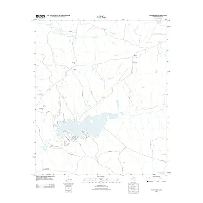
2013 Map of Hays Spring
USGS Topo · Published 2013About this map
Hays Spring sits as a central landmark in this portion of Houston County, characterized by a transition from traditional agricultural land to residential development around Houston County Lake. The landscape is heavily marked by family and community history, evidenced by a high density of burial sites including Pennington Cem, Walling Cem, and Meriwether Cem. The northern terrain is defined by the drainages of Big Elkhart Cr and Moccasin Br, while the southern portion reveals a complex network of residential streets such as Running Deer Rd and Tall Timber that skirt the irregular shoreline of the county lake. Local connectivity is maintained through several Farm to Market roads and the historical path of Old 229, linking the settlement at Coonskin Crossing with the surrounding rural reaches. The presence of numerous small water bodies like Pennington Lake and Farm Lake indicates a territory defined by its water resources and small-scale land management.
Find a feature on this map
75 named features on this map. Tap any name to fly to it.
Don’t see what you’re looking for? This feature index may not catch every label — zoom into the map to look around manually.
Map Details
Editions of this 2013 Hays Spring Map
This is the sole edition of this map. No revisions or reprints were ever made.
Other maps of this area

1950 · Crockett
USGS Topo · 1:24,000

1951 · Crockett
USGS Topo · 1:24,000

1951 · Grapeland
USGS Topo · 1:24,000

1951 · Elkhart
USGS Topo · 1:62,500

1952 · Slocum
USGS Topo · 1:62,500

1953 · Palestine
USGS Topo · 1:250,000

1957 · Palestine
USGS Topo · 1:250,000

1964 · Porter Springs
USGS Topo · 1:24,000

1964 · Halls Bluff
USGS Topo · 1:24,000

1964 · Hays Spring
USGS Topo · 1:24,000