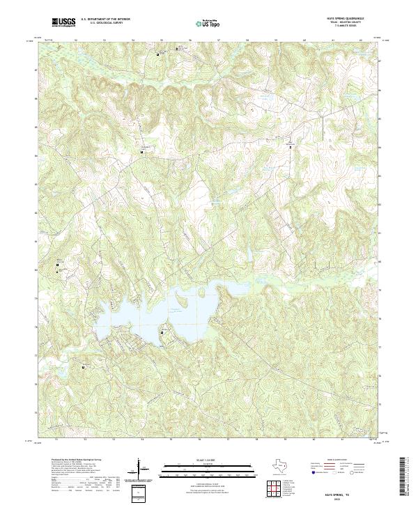
2022 Map of Hays Spring
USGS Topo · Published 2022About this map
Houston County Lake serves as the central geographic anchor for this part of East Texas, with its numerous inlets and residential developments like those along Lakeshore Dr and Lakeview Dr. The surrounding landscape is defined by a dense network of creek drainages, including Big Elkhart Cr and Pennington Br, which feed into the larger reservoir system. For those researching local family history, the map is a significant resource for locating small rural burial sites. Numerous cemeteries are scattered throughout the wooded terrain, from Rocky Spring Cem and Sheridan Graves in the north to Hall Cem and McCann Cem further south. The presence of several named springs, such as Caney Creek Springs and Hays Branch Springs, highlights the historical importance of natural water sources in the region's early settlement patterns.
Find a feature on this map
73 named features on this map. Tap any name to fly to it.
Don’t see what you’re looking for? This feature index may not catch every label — zoom into the map to look around manually.
Map Details
Editions of this 2022 Hays Spring Map
This is the sole edition of this map. No revisions or reprints were ever made.
Other maps of this area

1950 · Crockett
USGS Topo · 1:24,000

1951 · Crockett
USGS Topo · 1:24,000

1951 · Grapeland
USGS Topo · 1:24,000

1951 · Elkhart
USGS Topo · 1:62,500

1952 · Slocum
USGS Topo · 1:62,500

1953 · Palestine
USGS Topo · 1:250,000

1957 · Palestine
USGS Topo · 1:250,000

1964 · Porter Springs
USGS Topo · 1:24,000

1964 · Halls Bluff
USGS Topo · 1:24,000

1964 · Hays Spring
USGS Topo · 1:24,000