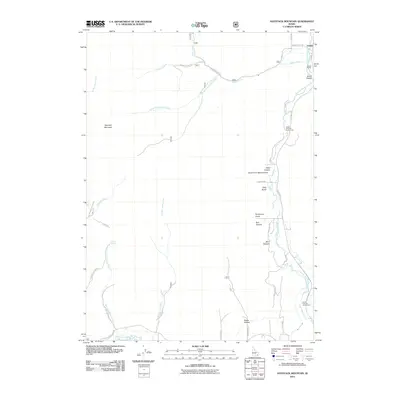
2011 Map of Haystack Mountain
USGS Topo · Published 2011About this map
The Portneuf River corridor dominates the eastern edge of this Idaho landscape, where the small settlement of Pebble and the railroad-adjacent Pebble Siding sit near the mouth of Smith Canyon. The terrain rises sharply to the west, culminating at Haystack Mountain, a prominent peak that separates the major drainage basins of the area. This 2011 survey captures a mix of modern infrastructure and deep historical routes, most notably the Old Oregon Trail Rd traversing the southern portion of the sheet. Numerous seasonal and perennial streams like West Bob Smith Creek and Robbers Roost Creek carve through deep canyons such as Reed Canyon and Bell Canyon, highlighting a complex hydrologic network that feeds into the Portneuf. Public access points like the Upper Portneuf Access Area indicate the river's ongoing importance for local recreation and water management.
Find a feature on this map
39 named features on this map. Tap any name to fly to it.
Don’t see what you’re looking for? This feature index may not catch every label — zoom into the map to look around manually.
Map Details
Editions of this 2011 Haystack Mountain Map
This is the sole edition of this map. No revisions or reprints were ever made.
Other maps of this area

1917 · Portneuf
USGS Topo · 1:62,500

1948 · Bancroft
USGS Topo · 1:62,500

1949 · Bancroft
USGS Topo · 1:62,500

1954 · Pocatello
USGS Topo · 1:250,000

1955 · Preston
USGS Topo · 1:250,000

1958 · Pocatello
USGS Topo · 1:250,000

1958 · Preston
USGS Topo · 1:250,000

1962 · Preston
USGS Topo · 1:250,000

1968 · Bear Camp Gulch
USGS Topo · 1:24,000

1968 · Lava Hot Springs
USGS Topo · 1:24,000