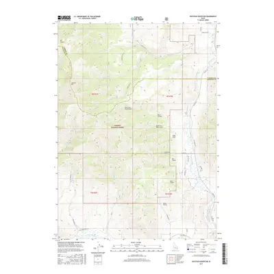
2017 Map of Haystack Mountain
USGS Topo · Published 2017About this map
Haystack Mtn anchors this high-elevation landscape where the Bannock and Caribou county line meets the Caribou National Forest. The eastern edge of the quadrangle follows the fertile valley of the Portneuf River, a primary corridor for transportation infrastructure including the Blazer Hwy and various routes connecting the region. The map captures a complex drainage system characterized by deep incisions like Reed Canyon and Bell Canyon, which feed into the main river valley from the surrounding slopes.
Find a feature on this map
45 named features on this map. Tap any name to fly to it.
Don’t see what you’re looking for? This feature index may not catch every label — zoom into the map to look around manually.
Map Details
Editions of this 2017 Haystack Mountain Map
This is the sole edition of this map. No revisions or reprints were ever made.
Other maps of this area

1917 · Portneuf
USGS Topo · 1:62,500

1948 · Bancroft
USGS Topo · 1:62,500

1949 · Bancroft
USGS Topo · 1:62,500

1954 · Pocatello
USGS Topo · 1:250,000

1955 · Preston
USGS Topo · 1:250,000

1958 · Pocatello
USGS Topo · 1:250,000

1958 · Preston
USGS Topo · 1:250,000

1962 · Preston
USGS Topo · 1:250,000

1968 · Bear Camp Gulch
USGS Topo · 1:24,000

1968 · Lava Hot Springs
USGS Topo · 1:24,000