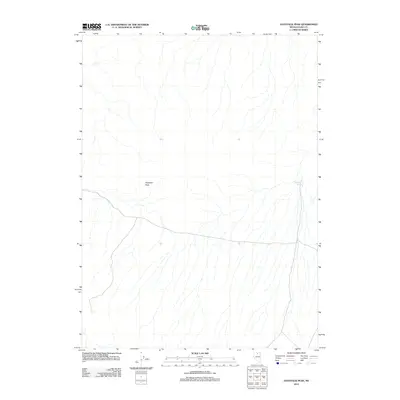
2012 Map of Haystack Peak
USGS Topo · Published 2012About this map
Haystack Peak serves as the central landmark for this arid stretch of Elko County, where the high desert terrain is defined by a network of seasonal drainages and isolated water sources. As recorded in 2012, the landscape is primarily defined by its hydrological features, with McFadden Spring providing a critical point of reference in the northeastern portion of the sheet. The topographical survey highlights the sparse infrastructure of this remote area, illustrating how the natural landforms dictate the passage through the Great Basin. This edition reflects the quiet character of the Nevada high country, where named landmarks are rare and survival is closely tied to the few available springs and the prominent peaks that guide travelers across the basin.
Find a feature on this map
2 named features on this map. Tap any name to fly to it.
Don’t see what you’re looking for? This feature index may not catch every label — zoom into the map to look around manually.
Map Details
Editions of this 2012 Haystack Peak Map
This is the sole edition of this map. No revisions or reprints were ever made.
Other maps of this area

1955 · McDermitt
USGS Topo · 1:250,000

1959 · McDermitt
USGS Topo · 1:250,000

1973 · Snowstorm Mtn
USGS Topo · 1:24,000
1973 · Rodear Flat
USGS Topo · 1:24,000

1973 · McCleary Wells
USGS Topo · 1:24,000

1973 · Haystack Peak
USGS Topo · 1:24,000

1973 · Humboldt Hill
USGS Topo · 1:24,000

1974 · Winters Ranch Reservoir
USGS Topo · 1:24,000

1974 · Burner Hills
USGS Topo · 1:24,000

1977 · Scraper Springs
USGS Topo · 1:24,000