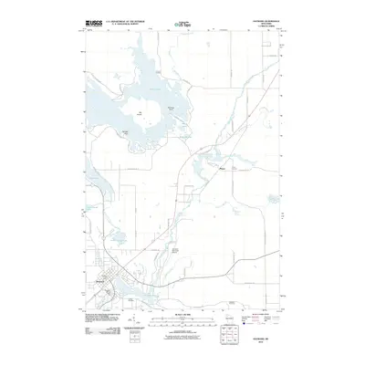
2010 Map of Hayward
USGS Topo · Published 2010About this map
The Namekagon River serves as the central artery for this portion of Sawyer County, winding past the community of Phipps and through the city of Hayward. The landscape is defined by its glacial hydrology, with Nelson Lake dominating the northern territory and smaller basins like Indian School Lake and Little Round Lake scattered throughout. Grounded in the early 21st century, the map documents the transition from wilder riparian zones to settled infrastructure, including the Hayward Municipal Airport and the Hayward WP119 Dam. Genealogists and local historians can locate the Trinity Cemetery near Phipps and the Indian Cemetery further south, while the Hayward Fire Tower stands as a landmark of regional forest management. The presence of Lenroot Landing on the northern shore of Nelson Lake highlights the area's established role as a destination for water-based activities and woodland access.
Find a feature on this map
64 named features on this map. Tap any name to fly to it.
Don’t see what you’re looking for? This feature index may not catch every label — zoom into the map to look around manually.
Map Details
Editions of this 2010 Hayward Map
This is the sole edition of this map. No revisions or reprints were ever made.
Other maps of this area

1944 · Couderay
USGS Topo · 1:48,000

1944 · Hayward
USGS Topo · 1:48,000

1947 · Chittamo
USGS Topo · 1:48,000

1948 · Couderay
USGS Topo · 1:48,000

1948 · Stone Lake
USGS Topo · 1:48,000

1949 · Chittamo
USGS Topo · 1:48,000

1950 · Stone Lake
USGS Topo · 1:48,000

1953 · Ashland
USGS Topo · 1:250,000

1953 · Rice Lake
USGS Topo · 1:250,000

1958 · Ashland
USGS Topo · 1:250,000