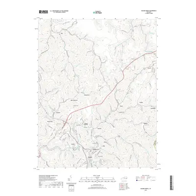
2019 Map of Hazard North
USGS Topo · Published 2019About this map
Hazard and its northern coalfield communities are captured here along the tight valley corridors of Lott's Creek and Troublesome Creek. This 2019 survey documents the complex geography of Perry County, where settlements like Blue Diamond, Bonnyman, and Hardburly are etched into the steep terrain. The influence of the coal industry is evident in the rail infrastructure of the L and N RR and the winding paths of Hardburly Rd and Lotts Creek Rd.
Find a feature on this map
138 named features on this map. Tap any name to fly to it.
Don’t see what you’re looking for? This feature index may not catch every label — zoom into the map to look around manually.
Map Details
Editions of this 2019 Hazard North Map
This is the sole edition of this map. No revisions or reprints were ever made.
Other maps of this area

1891 · Hazard
USGS Topo · 1:125,000

1913 · Buckhorn
USGS Topo · 1:62,500

1914 · Troublesome
USGS Topo · 1:62,500

1916 · Cornettsville
USGS Topo · 1:62,500

1916 · Hyden
USGS Topo · 1:48,000

1919 · Hyden
USGS Topo · 1:62,500

1954 · Noble
USGS Topo · 1:24,000

1954 · Krypton
USGS Topo · 1:24,000
1954 · Hyden East
USGS Topo · 1:24,000
1954 · Haddix
USGS Topo · 1:24,000