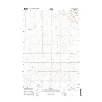
2016 Map of Hazel Run
USGS Topo · Published 2016About this map
Hazel Run sits at the southern edge of this Minnesota landscape, where the prairie is etched by a geometric grid of rural roads and agricultural drainage projects. The area is defined by the legacy of early Norwegian settlement, as evidenced by the presence of Bergen and the Bergen Cem further north. The terrain is relatively level, yet it is cut by the natural course of Stony Run Cr and the engineered paths of water management systems like County Ditch Number Six. Near the boundary of Chippewa Co and Yellow Medicine Co, the Camp Release Cem serves as a significant site of local memory. This 2016 survey documents a landscape that remains deeply tied to its farming roots, with many sections organized by the Public Land Survey System as noted by the Township and Range identifiers.
Find a feature on this map
26 named features on this map. Tap any name to fly to it.
Don’t see what you’re looking for? This feature index may not catch every label — zoom into the map to look around manually.
Map Details
Editions of this 2016 Hazel Run Map
This is the sole edition of this map. No revisions or reprints were ever made.
Other maps of this area

1953 · New Ulm
USGS Topo · 1:250,000

1957 · New Ulm
USGS Topo · 1:250,000

1958 · New Ulm
USGS Topo · 1:250,000

1962 · Wood Lake NW
USGS Topo · 1:24,000

1962 · Wood Lake
USGS Topo · 1:24,000

1965 · Montevideo
USGS Topo · 1:24,000

1965 · Clarkfield
USGS Topo · 1:24,000
1965 · Clarkfield NE
USGS Topo · 1:24,000

1965 · Asbury
USGS Topo · 1:24,000

1965 · Hazel Run
USGS Topo · 1:24,000