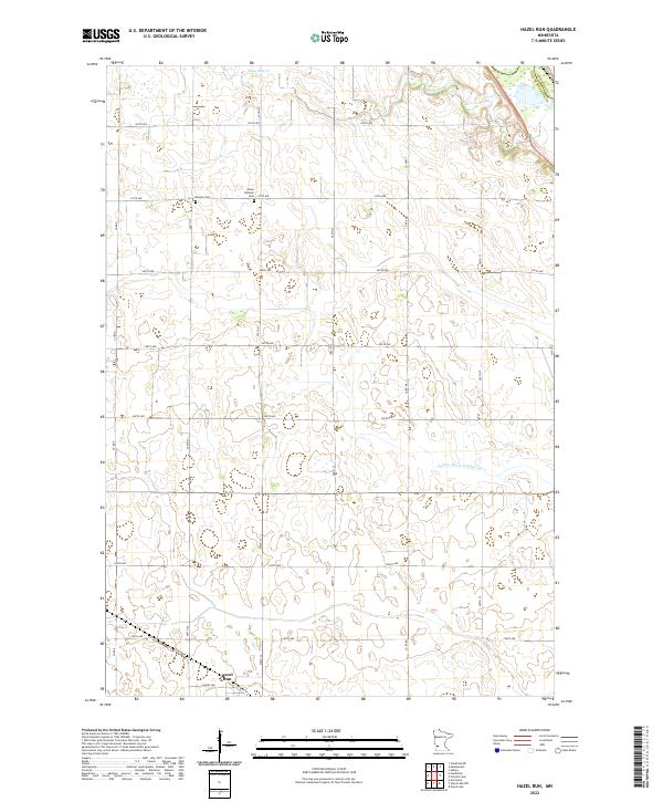
2022 Map of Hazel Run
USGS Topo · Published 2022About this map
Hazel Run serves as the primary settlement within this prairie landscape, where the town grid meets the agricultural section lines of Yellow Medicine County. The terrain is defined by a dense network of water management features and natural drainage, most notably the winding course of Stony Run Cr in the north and the engineered County Ditch Number Six a to the east. These waterways illustrate the long-standing efforts to manage the tillable land in this part of Minnesota.
Find a feature on this map
28 named features on this map. Tap any name to fly to it.
Don’t see what you’re looking for? This feature index may not catch every label — zoom into the map to look around manually.
Map Details
Editions of this 2022 Hazel Run Map
This is the sole edition of this map. No revisions or reprints were ever made.
Other maps of this area

1953 · New Ulm
USGS Topo · 1:250,000

1957 · New Ulm
USGS Topo · 1:250,000

1958 · New Ulm
USGS Topo · 1:250,000

1962 · Wood Lake NW
USGS Topo · 1:24,000

1962 · Wood Lake
USGS Topo · 1:24,000

1965 · Montevideo
USGS Topo · 1:24,000

1965 · Clarkfield
USGS Topo · 1:24,000
1965 · Clarkfield NE
USGS Topo · 1:24,000

1965 · Asbury
USGS Topo · 1:24,000

1965 · Hazel Run
USGS Topo · 1:24,000