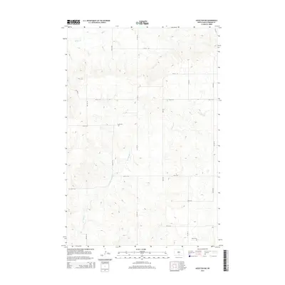
2014 Map of Hazelton NW
USGS Topo · Published 2014About this map
Horsehead Creek and Badger Creek wind through this prairie landscape in North Dakota, where the topography is defined by the subtle drainage patterns of the Missouri Plateau. The map reveals a strictly regulated section-line road network, including thoroughfares such as Main Ave and 1st Ave SW, which facilitate movement through this agricultural region. For those researching local family history, the placement of the Gimble Cemetery and the Merkle Cemetery provides specific geographic coordinates for early settler burial grounds. This 2014 survey documents the enduring rural character of Emmons County, where the sparse placement of named features reflects a late-modern era of consolidated farmsteads and open grazing land.
Find a feature on this map
21 named features on this map. Tap any name to fly to it.
Don’t see what you’re looking for? This feature index may not catch every label — zoom into the map to look around manually.
Map Details
Editions of this 2014 Hazelton NW Map
This is the sole edition of this map. No revisions or reprints were ever made.
Other maps of this area

1907 · Bismarck
USGS Topo · 1:125,000

1954 · Bismarck
USGS Topo · 1:250,000

1958 · Bismarck
USGS Topo · 1:250,000

1968 · Cannon Ball
USGS Topo · 1:24,000

1968 · Cannon Ball SE
USGS Topo · 1:24,000

1971 · Moffit SW
USGS Topo · 1:24,000

1971 · Hazelton
USGS Topo · 1:24,000

1971 · Moffit SE
USGS Topo · 1:24,000

1971 · Fort Rice
USGS Topo · 1:24,000

1971 · Hazelton SW
USGS Topo · 1:24,000