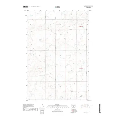
2017 Map of Hazelton NW
USGS Topo · Published 2017About this map
Horsehead Creek meanders through this portion of North Dakota, defining the drainage patterns across a landscape organized by the Public Land Survey System. The map documents rural Emmons County during a period of modern agricultural use, where the straight lines of section boundaries and section roads like 1st Ave SW contrast with the winding paths of natural waterways. Genealogists and local historians will find significant value in the presence of family-linked sites, specifically the Gimble Cemetery in the western reaches and the Fredrich Merkel Cemetery located near the southeastern corner. These small burial grounds serve as quiet markers of the families who settled this prairie land. The topography is further characterized by Badger Creek and a network of gravel roads, including Faw Cett Pl and Main Ave, that connect the isolated farmsteads and fields of the high plains.
Find a feature on this map
23 named features on this map. Tap any name to fly to it.
Don’t see what you’re looking for? This feature index may not catch every label — zoom into the map to look around manually.
Map Details
Editions of this 2017 Hazelton NW Map
This is the sole edition of this map. No revisions or reprints were ever made.
Other maps of this area

1907 · Bismarck
USGS Topo · 1:125,000

1954 · Bismarck
USGS Topo · 1:250,000

1958 · Bismarck
USGS Topo · 1:250,000

1968 · Cannon Ball
USGS Topo · 1:24,000

1968 · Cannon Ball SE
USGS Topo · 1:24,000

1971 · Moffit SW
USGS Topo · 1:24,000

1971 · Hazelton
USGS Topo · 1:24,000

1971 · Moffit SE
USGS Topo · 1:24,000

1971 · Fort Rice
USGS Topo · 1:24,000

1971 · Hazelton SW
USGS Topo · 1:24,000