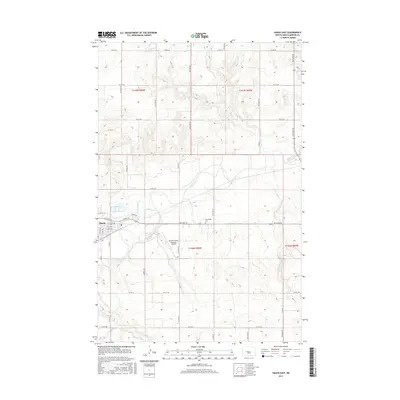
2017 Map of Hazen East
USGS Topo · Published 2017About this map
Hazen anchor this Mercer County landscape as it appeared in the late 2010s, with the eastern residential streets and critical infrastructure defined by the Mercer County Regional Airport. The topography is shaped by the meandering Knife River, which cuts through the central section of the map, fed by numerous tributaries including Antelope Cr and Kinneman Cr. The local road network, including Highway Dr and Sunrise Dr, provides a clear view of the modern development patterns extending from the town center.
Find a feature on this map
29 named features on this map. Tap any name to fly to it.
Don’t see what you’re looking for? This feature index may not catch every label — zoom into the map to look around manually.
Map Details
Editions of this 2017 Hazen East Map
This is the sole edition of this map. No revisions or reprints were ever made.
Other maps of this area
1948 · Stanton
USGS Topo · 1:62,500
1949 · Stanton
USGS Topo · 1:62,500
1954 · McClusky
USGS Topo · 1:250,000
1958 · McClusky
USGS Topo · 1:250,000
1968 · Red Butte
USGS Topo · 1:24,000
1968 · Red Butte NW
USGS Topo · 1:24,000
1968 · Hazen West
USGS Topo · 1:24,000
1968 · Stanton
USGS Topo · 1:24,000
1968 · Hannover NW
USGS Topo · 1:24,000
1968 · Hazen East
USGS Topo · 1:24,000