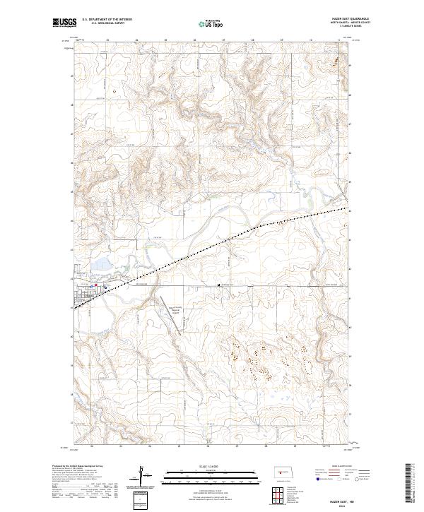
2024 Map of Hazen East
USGS Topo · Published 2024About this map
Hazen serves as the primary hub in this portion of Mercer County, situated where Antelope Creek meets the broader valley of the Knife River. The landscape is defined by the winding paths of several waterways, including Coal Creek, Kinneman Creek, and Brady Creek, which carve through the plains. Local infrastructure is anchored by the Mercer County Regional Airport and the historic Cambridge Cem located to the east. A dense grid of section roads, such as Co Rd 18 and Co Rd 20, provides access across the townships of t144n r86w, t145n r86w, t144n r85w, and t145n r85w. This map illustrates the intersection of small-town development and the essential drainage systems that support the regional prairie environment.
Find a feature on this map
31 named features on this map. Tap any name to fly to it.
Don’t see what you’re looking for? This feature index may not catch every label — zoom into the map to look around manually.
Map Details
Editions of this 2024 Hazen East Map
This is the sole edition of this map. No revisions or reprints were ever made.
Other maps of this area

1948 · Stanton
USGS Topo · 1:62,500

1949 · Stanton
USGS Topo · 1:62,500

1954 · McClusky
USGS Topo · 1:250,000

1958 · McClusky
USGS Topo · 1:250,000

1968 · Red Butte
USGS Topo · 1:24,000

1968 · Red Butte NW
USGS Topo · 1:24,000

1968 · Hazen West
USGS Topo · 1:24,000

1968 · Stanton
USGS Topo · 1:24,000

1968 · Hannover NW
USGS Topo · 1:24,000

1968 · Hazen East
USGS Topo · 1:24,000