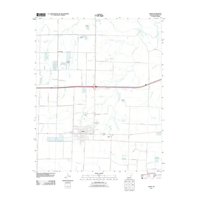
2011 Map of Hazen
USGS Topo · Published 2011About this map
Hazen serves as the central hub of this eastern Arkansas landscape, where the grid of the town site meets a complex network of agricultural drainage and creek systems. To the north, the small settlement of Tarnceville sits near a series of managed water bodies, including Floyds Reservoir and Jerome Lake, reflecting the region's reliance on water control for farming. The terrain is defined by the winding paths of Wattensaw Bayou and the extensive Hurricane Creek system, which flows southward toward Oak Creek. Local history is anchored by the Hazen Cemetery and the Old Bethel Cemetery, while aviation and transit are represented by Fowlkes Field and a dense grid of county roads. The map illustrates a developed rural economy where infrastructure like the Crowley Lake Dam supports the land's transition from wetlands to productive acreage.
Find a feature on this map
52 named features on this map. Tap any name to fly to it.
Don’t see what you’re looking for? This feature index may not catch every label — zoom into the map to look around manually.
Map Details
Editions of this 2011 Hazen Map
This is the sole edition of this map. No revisions or reprints were ever made.
Other maps of this area

1935 · Hazen
USGS Topo · 1:62,500

1935 · Clarendon
USGS Topo · 1:62,500

1937 · Stuttgart
USGS Topo · 1:62,500

1939 · Stuttgart
USGS Topo · 1:62,500

1941 · Hazen
USGS Topo · 1:62,500

1941 · De Valls Bluff
USGS Topo · 1:62,500

1941 · Clarendon
USGS Topo · 1:62,500

1948 · Helena
USGS Topo · 1:250,000

1950 · Helena
USGS Topo · 1:250,000

1955 · Helena
USGS Topo · 1:250,000