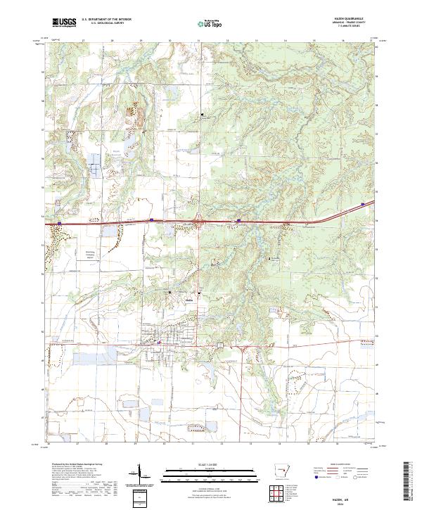
2024 Map of Hazen
USGS Topo · Published 2024About this map
Hazen serves as the central hub of this Prairie County survey, showing a grid of residential streets and localized infrastructure including the Hazen Cem and Prairie Chapel Cem. The landscape is defined by the subtle rise of Crowley Ridge to the north, a geologic anomaly that influences the surrounding drainage patterns of Wattensaw Bayou and Hurricane Creek. These waterways, along with numerous man-made features like Floyds Reservoir and Sims Reservoir, illustrate a rural economy deeply tied to water management and agriculture.
Find a feature on this map
95 named features on this map. Tap any name to fly to it.
Don’t see what you’re looking for? This feature index may not catch every label — zoom into the map to look around manually.
Map Details
Editions of this 2024 Hazen Map
This is the sole edition of this map. No revisions or reprints were ever made.
Other maps of this area

1935 · Hazen
USGS Topo · 1:62,500

1935 · Clarendon
USGS Topo · 1:62,500

1937 · Stuttgart
USGS Topo · 1:62,500

1939 · Stuttgart
USGS Topo · 1:62,500

1941 · Hazen
USGS Topo · 1:62,500

1941 · De Valls Bluff
USGS Topo · 1:62,500

1941 · Clarendon
USGS Topo · 1:62,500

1948 · Helena
USGS Topo · 1:250,000

1950 · Helena
USGS Topo · 1:250,000

1955 · Helena
USGS Topo · 1:250,000