
1968 Map of Hazen West
USGS Topo · Published 1969About this map
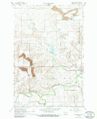
Knife River and Antelope Creek dominate this Mercer County landscape, where the local economy in the late 1960s was defined by coal extraction and a robust rail network. Extensive Strip Mine operations are evident north of the Northern Pacific line, including specialized infrastructure near the small community of Truax. To the east, the edge of Hazen serves as a residential anchor, positioned near the confluence of local waterways and the railroad. Water management is a visible priority on the land, evidenced by the Schramm Dam and its associated Spillway Elev 1805. For genealogists, the map preserves the exact locations of rural burial grounds, including Wolfe Cem, St Martins Cem, and St Mathews Cem, providing a clear look at the spatial relationship between these community landmarks and the expanding industrial footprint of the era.
Find a feature on this map
15 named features on this map. Tap any name to fly to it.
Don’t see what you’re looking for? This feature index may not catch every label — zoom into the map to look around manually.
Map Details
Editions of this 1968 Hazen West Map
2 editions found
Other maps of this area

1954 · McClusky
USGS Topo · 1:250,000

1958 · McClusky
USGS Topo · 1:250,000

1968 · Red Butte
USGS Topo · 1:24,000

1968 · Beulah
USGS Topo · 1:24,000

1968 · Medicine Butte NE
USGS Topo · 1:24,000

1968 · Red Butte NW
USGS Topo · 1:24,000

1968 · Hazen East
USGS Topo · 1:24,000

1969 · Hazen NE
USGS Topo · 1:24,000

1969 · Beulah NE
USGS Topo · 1:24,000
1969 · Hazen NW
USGS Topo · 1:24,000