
1963 Map of Hazlehurst
USGS Topo · Published 1964About this map
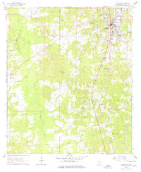
Hazlehurst serves as the primary hub of this Copiah County landscape during the early 1960s, anchored by the north-south corridor of the Illinois Central railroad. The surrounding terrain is defined by the winding course of Bayou Pierre and its numerous tributaries like Mill Creek and Brushy Creek, which carve through the wooded hills. Rural life is centered around a network of small settlements and faith landmarks, including Martinsville to the south and the older site of Gallatin to the west. Genealogists will find significant value in the numerous family and community burial grounds documented here, such as Wade Cem, Tyson Cem, and Antioch Cem. The presence of several Gravel Pits and the Hazlehurst Lookout Tower indicates a landscape balanced between local industry, forestry, and small-scale agriculture, with the Sewage Disposal Pond and Parrish Sch marking the infrastructure of the growing county seat.
Find a feature on this map
35 named features on this map. Tap any name to fly to it.
Don’t see what you’re looking for? This feature index may not catch every label — zoom into the map to look around manually.
Map Details
Editions of this 1963 Hazlehurst Map
2 editions found
Other maps of this area

1953 · Natchez
USGS Topo · 1:250,000

1956 · Natchez
USGS Topo · 1:250,000

1959 · Natchez
USGS Topo · 1:250,000

1963 · Dentville
USGS Topo · 1:24,000
1963 · Crystal Springs
USGS Topo · 1:24,000

1963 · Smyrna
USGS Topo · 1:24,000
1963 · Gallman
USGS Topo · 1:24,000

1963 · Shady Grove
USGS Topo · 1:24,000

1972 · Midway
USGS Topo · 1:24,000
1972 · Stronghope
USGS Topo · 1:24,000