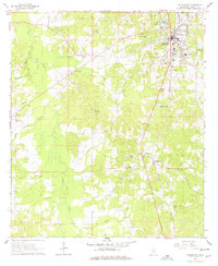
1963 Map of Hazlehurst
USGS Topo · Published 1978About this map
The Illinois Central railroad corridor anchors this mid-century view of Copiah County, running north-south through the commercial center of Hazlehurst. The landscape is a transition from the urban street grid of the county seat to the dispersed agricultural and timber lands of the surrounding countryside. Rural life is traced through a dense network of country congregations and burial grounds, including New Salem Ch, Center Point Ch, and the Wade Cem.
Find a feature on this map
38 named features on this map. Tap any name to fly to it.
Don’t see what you’re looking for? This feature index may not catch every label — zoom into the map to look around manually.
Map Details
Editions of this 1963 Hazlehurst Map
2 editions found
Other maps of this area

1953 · Natchez
USGS Topo · 1:250,000

1956 · Natchez
USGS Topo · 1:250,000

1959 · Natchez
USGS Topo · 1:250,000

1963 · Dentville
USGS Topo · 1:24,000
1963 · Crystal Springs
USGS Topo · 1:24,000

1963 · Smyrna
USGS Topo · 1:24,000
1963 · Gallman
USGS Topo · 1:24,000

1963 · Hazlehurst
USGS Topo · 1:24,000

1963 · Shady Grove
USGS Topo · 1:24,000

1972 · Midway
USGS Topo · 1:24,000