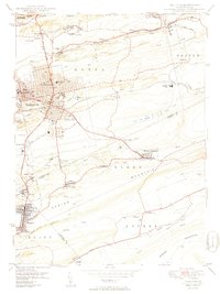
1950 Map of Hazleton
USGS Topo · Published 1950About this map
Hazleton and West Hazleton anchor this post-war landscape, where the anthracite region's industrial footprint is etched into every valley. The mapping, based on 1942 aerial photography, documents a complex network of collieries and mining settlements such as Lattimer Mines (PO), Ebervale, and Jeddo. The influence of the Lehigh Valley railroad is evident in the extensive Ashmore Yards and the numerous spurs threading through the hills toward Beaver Meadows and Audenried.
Find a feature on this map
64 named features on this map. Tap any name to fly to it.
Don’t see what you’re looking for? This feature index may not catch every label — zoom into the map to look around manually.
Map Details
Editions of this 1950 Hazleton Map
2 editions found
Other maps of this area

1889 · Hazleton
USGS Topo · 1:62,500

1891 · Wilkesbarre
USGS Topo · 1:62,500

1891 · Hazleton
USGS Topo · 1:62,500

1892 · Mahanoy
USGS Topo · 1:62,500

1893 · Hazleton
USGS Topo · 1:62,500

1893 · Mahanoy
USGS Topo · 1:62,500

1894 · Shickshinny
USGS Topo · 1:62,500

1894 · Wilkesbarre
USGS Topo · 1:62,500

1943 · Scranton
USGS Topo · 1:125,000

1944 · Newark
USGS Topo · 1:250,000