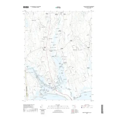
2018 Map of Head of Westport
USGS Topo · Published 2018About this map
Westport Point and the intricate coastal estuaries of Bristol County define this landscape, where the East Branch Westport River and West Branch Westport River converge before meeting the Atlantic Ocean. The region is marked by a dense network of historical hamlets and road junctions including Central Village, South Westport, and Handy Four Corners. This 2018 survey captures the balance between maritime geography and long-established settlement patterns, from the northern Head of Westport down to the barrier beach at Horseneck Beach. Inland, the map reveals numerous small family and community cemeteries like Beech Grove Cem and Maple Grove Cem, alongside local landmarks such as Westport Airport and Camp Noquochoke. The proximity to the Rhode Island border is evident at Acoaxet, showing the historical continuity of this coastal New England corner.
Find a feature on this map
171 named features on this map. Tap any name to fly to it.
Don’t see what you’re looking for? This feature index may not catch every label — zoom into the map to look around manually.
Map Details
Editions of this 2018 Head of Westport Map
This is the sole edition of this map. No revisions or reprints were ever made.
Other maps of this area

1885 · New Bedford
USGS Topo · 1:62,500

1885 · Sakonnet
USGS Topo · 1:62,500

1888 · New Bedford
USGS Topo · 1:62,500

1888 · Fall River
USGS Topo · 1:62,500

1888 · Sakonnet
USGS Topo · 1:62,500

1893 · Sakonnet
USGS Topo · 1:62,500

1893 · Fall River
USGS Topo · 1:62,500

1893 · New Bedford
USGS Topo · 1:62,500

1918 · New Bedford
USGS Topo · 1:62,500

1919 · Fall River
USGS Topo · 1:62,500