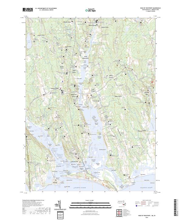
2024 Map of Head of Westport
USGS Topo · Published 2024About this map
Head of Westport and the surrounding coastal landscape are defined by the convergence of the East Branch Westport River and West Branch Westport River as they flow toward the Atlantic Ocean. This recent survey illustrates a densely layered historical record, particularly visible through the dozens of family burial grounds and cemeteries that dot the interior, such as the Thaddeus Reynolds Burial Ground, George Wing Cem, and the sprawling Beech Grove Cem. The settlement pattern follows traditional crossroads like Giffords Corner and Central Village, while the southern shoreline is anchored by the maritime character of Westport Point and the protected waters of Westport Harbor. From the salt marshes of the Westport River East Branch Marshes to the long stretch of Horseneck Beach, the map documents a geography where family lineage and coastal ecology remain deeply intertwined.
Find a feature on this map
247 named features on this map. Tap any name to fly to it.
Don’t see what you’re looking for? This feature index may not catch every label — zoom into the map to look around manually.
Map Details
Editions of this 2024 Head of Westport Map
This is the sole edition of this map. No revisions or reprints were ever made.
Other maps of this area

1885 · New Bedford
USGS Topo · 1:62,500

1885 · Sakonnet
USGS Topo · 1:62,500

1888 · New Bedford
USGS Topo · 1:62,500

1888 · Fall River
USGS Topo · 1:62,500

1888 · Sakonnet
USGS Topo · 1:62,500

1893 · Sakonnet
USGS Topo · 1:62,500

1893 · Fall River
USGS Topo · 1:62,500

1893 · New Bedford
USGS Topo · 1:62,500

1918 · New Bedford
USGS Topo · 1:62,500

1919 · Fall River
USGS Topo · 1:62,500