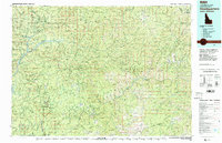
1982 Map of Headquarters
USGS Topo · Published 1983About this map
Dworshak Reservoir dominates the western reaches of this North Idaho landscape, where the North Fork Clearwater River and its tributaries carve through the heavy timber of the Clearwater National Forest and St Joe National Forest. The map documents a rugged timber and mining economy in the early 1980s, centered around the company town of Headquarters and the historic settlement of Pierce. Industrial activity is evident in the cluster of remote outposts such as Hollywood, Jaype, and Townsite Four, alongside numerous specialized camps like Camp 14 and Camp 60. Mineral extraction is recorded at the Oxford Mine, Democrat Mine, and Crawford Mine. Transportation for these resources is facilitated by the Cardiff Spur railroad line and a network of logging roads and 4wd trails that navigate prominent heights including Bertha Hill and Cook Mountain.
Find a feature on this map
158 named features on this map. Tap any name to fly to it.
Don’t see what you’re looking for? This feature index may not catch every label — zoom into the map to look around manually.
Map Details
Editions of this 1982 Headquarters Map
This is the sole edition of this map. No revisions or reprints were ever made.
Other maps of this area

1911 · Lolo
USGS Topo · 1:250,000

1913 · Lolo
USGS Topo · 1:250,000

1914 · Avery
USGS Topo · 1:125,000

1917 · Avery
USGS Topo · 1:125,000

1918 · St Regis
USGS Topo · 1:125,000

1919 · St. Regis
USGS Topo · 1:125,000

1923 · Washington Creek
USGS Topo · 1:125,000

1924 · Kamiah
USGS Topo · 1:125,000

1924 · Weippe
USGS Topo · 1:125,000

1936 · Boehls Butte
USGS Topo · 1:48,000