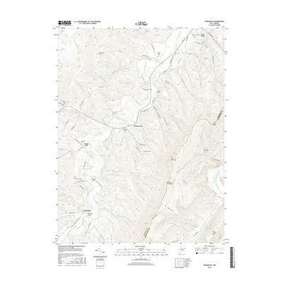
2016 Map of Headsville
USGS Topo · Published 2016About this map
Fort Ashby anchors the northeastern corner of this West Virginia landscape, where the ridges of Patterson Creek Mtn define the local topography. This modern topographic study reveals a terrain deeply influenced by the north-flowing waters of Patterson Creek, which carves through a series of parallel valleys. Researchers of local history will find numerous ancestral landmarks including the Broad Run Graveyard, Reece Cem, and the Headsville Cem, each reflecting the generations of families who settled these mountain gaps. The map highlights the enduring geography of rural crossroads like Champwood and Headsville, where bridges such as Headsville Bridge cross the central waterway, connecting small communities and farmsteads established along the valley floor.
Find a feature on this map
1 named feature on this map. Tap any name to fly to it.
Don’t see what you’re looking for? This feature index may not catch every label — zoom into the map to look around manually.
Map Details
Editions of this 2016 Headsville Map
This is the sole edition of this map. No revisions or reprints were ever made.
Other maps of this area

1891 · Romney
USGS Topo · 1:125,000

1898 · Frostburg
USGS Topo · 1:62,500

1899 · Flintstone
USGS Topo · 1:62,500

1900 · Flintstone
USGS Topo · 1:62,500

1901 · Frostburg
USGS Topo · 1:62,500

1908 · Frostburg
USGS Topo · 1:62,500

1920 · Keyser
USGS Topo · 1:62,500

1921 · Keyser
USGS Topo · 1:48,000

1921 · Hanging Rock
USGS Topo · 1:48,000

1922 · Keyser
USGS Topo · 1:62,500