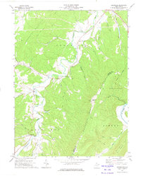
1973 Map of Headsville
USGS Topo · Published 1975About this map
Patterson Creek carves a winding path through the borderlands of Mineral and Hampshire counties, defining the agricultural and social geography of this 1970s landscape. Small rural communities like Headsville, Reeses Mill, and Champwood serve as anchors for local life, many organized around historic faith centers such as Eusebia Ch and Patterson Creek Ch. The terrain is dominated by the steep parallel ridges of Horseshoe Mountain and Springfield Mountain, where high points like Slate Lick Knob offer vantage points over the narrow hollows. A dense network of runs, including Cabin Run and Mikes Run, feed the main creek, illustrating the drainage patterns that dictated early road placement and property lines. The presence of a Lookout Tower and a Gaging Station reflects the ongoing 20th-century management of the area's timber and water resources.
Find a feature on this map
48 named features on this map. Tap any name to fly to it.
Don’t see what you’re looking for? This feature index may not catch every label — zoom into the map to look around manually.
Map Details
Editions of this 1973 Headsville Map
This is the sole edition of this map. No revisions or reprints were ever made.
Other maps of this area

1891 · Romney
USGS Topo · 1:125,000

1898 · Frostburg
USGS Topo · 1:62,500

1899 · Flintstone
USGS Topo · 1:62,500

1900 · Flintstone
USGS Topo · 1:62,500

1901 · Frostburg
USGS Topo · 1:62,500

1908 · Frostburg
USGS Topo · 1:62,500

1920 · Keyser
USGS Topo · 1:62,500

1921 · Keyser
USGS Topo · 1:48,000

1921 · Hanging Rock
USGS Topo · 1:48,000

1922 · Keyser
USGS Topo · 1:62,500