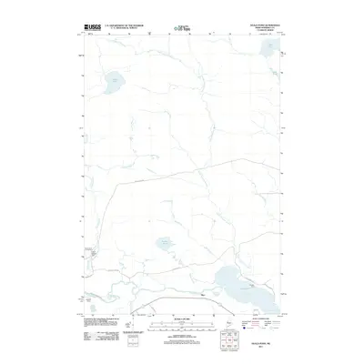
2011 Map of Heald Pond
USGS Topo · Published 2011About this map
Moose River defines the lower corridor of this Somerset County landscape, flowing through a series of expansive water bodies and wetlands in the Maine woods. Small settlements and named clearings like Blair, Whipple Farm, and Newton Field anchor the southern portion of the map, suggesting a history of isolated riverside habitation and agricultural effort. The northern reaches are dominated by the winding path of Upper Churchill Stream and a network of high-country waters including Heald Pond and Fish Pond. Infrastructure is sparse, primarily concentrated along the river valley where the Heald Stream Dam and Moose River Campground indicate a landscape managed for both utility and recreation. The orientation of roads such as Moose River Rd and Whipple Farm Rd follows the natural drainage patterns, highlighting the river's historical importance as the primary artery for movement through this heavily forested region.
Find a feature on this map
26 named features on this map. Tap any name to fly to it.
Don’t see what you’re looking for? This feature index may not catch every label — zoom into the map to look around manually.
Map Details
Editions of this 2011 Heald Pond Map
This is the sole edition of this map. No revisions or reprints were ever made.
Other maps of this area

1922 · Long Pond
USGS Topo · 1:62,500

1923 · Attean
USGS Topo · 1:62,500

1924 · Long Pond
USGS Topo · 1:62,500

1925 · Attean
USGS Topo · 1:62,500

1927 · Sandy Bay
USGS Topo · 1:48,000

1930 · Sandy Bay
USGS Topo · 1:62,500

1944 · Long Pond
USGS Topo · 1:62,500

1944 · Sandy Bay
USGS Topo · 1:62,500

1949 · Jackman
USGS Topo · 1:250,000

1950 · Attean
USGS Topo · 1:50,000
Featured Places
- Jackman, ME
- Moose River, ME
- Thorndike Township, ME
- Long Pond Township, ME
- Bald Mountain Township T4 R3, ME