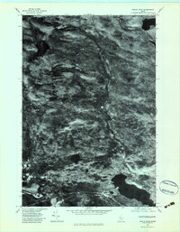
1977 Map of Heald Pond
USGS Topo · Published 1983About this map
The timber-rich terrain of Somerset County is captured here through aerial imagery, revealing the industrial and hydrological patterns of the late 1970s. The Jackman Mill sits at a critical junction near the western edge of the quadrangle, reflecting the region's enduring reliance on the forest products industry. This orthophotoquad provides a clear view of the complex water systems that define the area, dominated by the significant expanse of Long Pond and the winding course of the Moose River. Smaller water bodies like Blair Pond are scattered throughout the landscape, connected by a network of drainage including Churchill Stream, Heald Stream, and Barton Brook. The sharp contrast of the imagery highlights the density of the canopy and the clearings required for logging and transport infrastructure during this era.
Find a feature on this map
7 named features on this map. Tap any name to fly to it.
Don’t see what you’re looking for? This feature index may not catch every label — zoom into the map to look around manually.
Map Details
Editions of this 1977 Heald Pond Map
This is the sole edition of this map. No revisions or reprints were ever made.
Other maps of this area

1922 · Long Pond
USGS Topo · 1:62,500

1923 · Attean
USGS Topo · 1:62,500

1924 · Long Pond
USGS Topo · 1:62,500

1925 · Attean
USGS Topo · 1:62,500

1927 · Sandy Bay
USGS Topo · 1:48,000

1930 · Sandy Bay
USGS Topo · 1:62,500

1944 · Long Pond
USGS Topo · 1:62,500

1944 · Sandy Bay
USGS Topo · 1:62,500

1949 · Jackman
USGS Topo · 1:250,000

1950 · Attean
USGS Topo · 1:50,000
Featured Places
- Jackman, ME
- Moose River, ME
- Bald Mountain Township T4 R3, ME
- Long Pond Township, ME
- Thorndike Township, ME