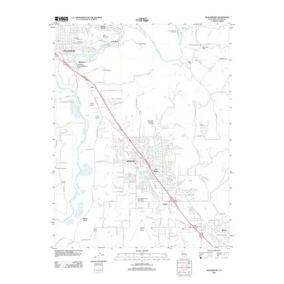
2012 Map of Healdsburg
USGS Topo · Published 2012About this map
Healdsburg and the surrounding Russian River valley appear here in 2012, showcasing a landscape defined by viticulture and aviation. The prominent bend of the Russian River winds past Fitch Mountain and through a series of famous vineyards, including Rodney Strong Vineyards and Piper Sonoma Cellars. To the south, the expansion of Windsor and East Windsor is evident, while the presence of the Sonoma County Airport and the Allan Ranch Flight Park Ultralight highlights the area's role as a regional transportation hub. Genealogists and local historians can locate long-standing sites such as Oak Mound Cem and Faught Cem. The map also captures the recreational character of the region, from Healdsburg Veterans Memorial Beach to the residential fairways of the Wikiup Golf Course near the community of Wikiup.
Find a feature on this map
118 named features on this map. Tap any name to fly to it.
Don’t see what you’re looking for? This feature index may not catch every label — zoom into the map to look around manually.
Map Details
Editions of this 2012 Healdsburg Map
This is the sole edition of this map. No revisions or reprints were ever made.
Other maps of this area

1916 · Santa Rosa
USGS Topo · 1:62,500

1920 · Healdsburg
USGS Topo · 1:62,500

1927 · Calistoga
USGS Topo · 1:62,500

1933 · Healdsburg
USGS Topo · 1:48,000

1935 · Sebastopol
USGS Topo · 1:48,000

1940 · Healdsburg
USGS Topo · 1:62,500

1942 · Sebastopol
USGS Topo · 1:62,500

1943 · Calistoga
USGS Topo · 1:62,500

1944 · Santa Rosa
USGS Topo · 1:62,500

1945 · Calistoga
USGS Topo · 1:62,500