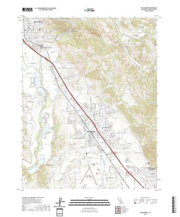
2021 Map of Healdsburg
USGS Topo · Published 2021About this map
The Russian River winds through this 2021 survey of central Sonoma County, framing a landscape defined by viticulture, aviation, and historic transit corridors. The topography is dominated by landmarks like Fitch Mtn, Chalk Hill, and the expansive Alexander Valley, while the human footprint centers on the incorporated areas of Healdsburg and Windsor. This modern sheet documents the enduring paths of the Old Redwood Hwy and the Northwestern Pacific RR, which parallel the high-speed transit of US Highway 101.
Find a feature on this map
167 named features on this map. Tap any name to fly to it.
Don’t see what you’re looking for? This feature index may not catch every label — zoom into the map to look around manually.
Map Details
Editions of this 2021 Healdsburg Map
This is the sole edition of this map. No revisions or reprints were ever made.
Other maps of this area

1916 · Santa Rosa
USGS Topo · 1:62,500

1920 · Healdsburg
USGS Topo · 1:62,500

1927 · Calistoga
USGS Topo · 1:62,500

1933 · Healdsburg
USGS Topo · 1:48,000

1935 · Sebastopol
USGS Topo · 1:48,000

1940 · Healdsburg
USGS Topo · 1:62,500

1942 · Sebastopol
USGS Topo · 1:62,500

1943 · Calistoga
USGS Topo · 1:62,500

1944 · Santa Rosa
USGS Topo · 1:62,500

1945 · Calistoga
USGS Topo · 1:62,500