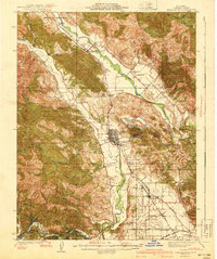
1940 Map of Healdsburg
USGS Topo · Published 1940About this map
The Russian River carves a winding path through this 1933 survey, anchoring the development of Sonoma County's northern valleys. The Northwestern Pacific railroad and the Redwood Highway run parallel through the river valley, connecting established hubs like Healdsburg, Geyserville, and Windsor. This corridor was the backbone of local industry and transport before the mid-century expansion of the regional road network, shown here with the intricate layout of early riverfront communities such as Del Rio Woods and Rio Nido.
Find a feature on this map
98 named features on this map. Tap any name to fly to it.
Don’t see what you’re looking for? This feature index may not catch every label — zoom into the map to look around manually.
Map Details
Editions of this 1940 Healdsburg Map
3 editions found
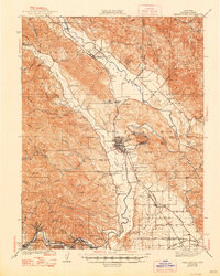
Other maps of this area

1916 · Santa Rosa
USGS Topo · 1:62,500

1920 · Healdsburg
USGS Topo · 1:62,500

1921 · Skaggs
USGS Topo · 1:62,500

1921 · Kelseyville
USGS Topo · 1:62,500

1927 · Calistoga
USGS Topo · 1:62,500

1933 · Healdsburg
USGS Topo · 1:48,000

1935 · Sebastopol
USGS Topo · 1:48,000

1938 · Hopland
USGS Topo · 1:62,500

1940 · Healdsburg
USGS Topo · 1:62,500

1942 · Sebastopol
USGS Topo · 1:62,500