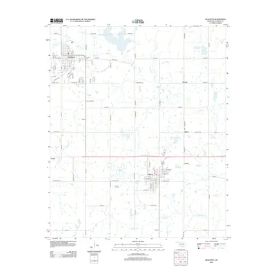
2012 Map of Healdton
USGS Topo · Published 2012About this map
The Oklahoma oil country around Healdton and Wilson is defined by its grid of rural roads and the drainage networks of Walnut Cr and Demijohn Cr. This 2012 survey documents the persistent small-town structure of Carter County, anchored by the larger settlements in the west and east. Genealogists will find significant value in the documentation of local burial grounds, including Mt Olive Cem near the Healdton townsite, Bomar Point Cem to the south, and Hewitt Cem further east. The landscape is also marked by modern water management features like Upper Bayou Site 8 Reservoir and Upper Bayou Site 17 Reservoir, which dot the terrain between the established communities of Dillard, Rexroat, and Hewitt. These landmarks, alongside historic thoroughfares like Slawson Rd and Golf Course Rd, provide a clear picture of the region's contemporary rural and residential layout.
Find a feature on this map
46 named features on this map. Tap any name to fly to it.
Don’t see what you’re looking for? This feature index may not catch every label — zoom into the map to look around manually.
Map Details
Editions of this 2012 Healdton Map
This is the sole edition of this map. No revisions or reprints were ever made.
Other maps of this area

1901 · Addington
USGS Topo · 1:125,000

1901 · Ardmore
USGS Topo · 1:125,000

1918 · Ardmore
USGS Topo · 1:125,000

1957 · Ardmore
USGS Topo · 1:250,000

1963 · Ardmore
USGS Topo · 1:250,000

1969 · Healdton
USGS Topo · 1:24,000

1969 · Lone Grove
USGS Topo · 1:24,000
1969 · Healdton SW
USGS Topo · 1:24,000
1969 · Milo
USGS Topo · 1:24,000
1969 · Healdton SE
USGS Topo · 1:24,000