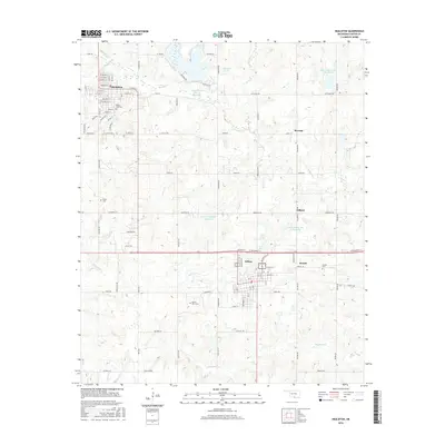
2016 Map of Healdton
USGS Topo · Published 2016About this map
Healdton and Wilson serve as the primary anchors for this region in southern Oklahoma, where a dense network of country roads like Exxon Rd and Tabor Rd reflects the area's legacy of energy production and rural settlement. The landscape is defined by the winding paths of Walnut Cr and Demijohn Cr, alongside numerous water management structures including Upper Bayou Site 10 Reservoir and Healdton Lake. Smaller communities such as Rexroat, Dillard, and Hewitt are scattered across the terrain, often identified by local landmarks like Hewitt Cem or Mount Olive Cem. The map's detail provides a look at the historical layout of these towns, including the residential grid of Healdton featuring streets named Kewanee St and Rockland St, and the local connection of Railroad St indicating the corridor's transportation history.
Find a feature on this map
63 named features on this map. Tap any name to fly to it.
Don’t see what you’re looking for? This feature index may not catch every label — zoom into the map to look around manually.
Map Details
Editions of this 2016 Healdton Map
This is the sole edition of this map. No revisions or reprints were ever made.
Other maps of this area

1901 · Addington
USGS Topo · 1:125,000

1901 · Ardmore
USGS Topo · 1:125,000

1918 · Ardmore
USGS Topo · 1:125,000

1957 · Ardmore
USGS Topo · 1:250,000

1963 · Ardmore
USGS Topo · 1:250,000

1969 · Healdton
USGS Topo · 1:24,000

1969 · Lone Grove
USGS Topo · 1:24,000
1969 · Healdton SW
USGS Topo · 1:24,000
1969 · Milo
USGS Topo · 1:24,000
1969 · Healdton SE
USGS Topo · 1:24,000