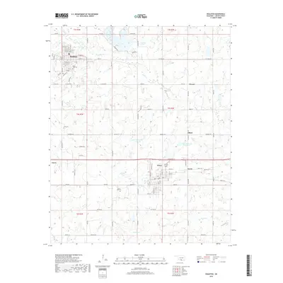
2018 Map of Healdton
USGS Topo · Published 2018About this map
Healdton and Wilson anchor this Carter County landscape, which reflects a dense network of petroleum-era infrastructure and rural settlements. The map illustrates a high density of secondary roads such as Oil Blvd and Texas St, connecting a series of smaller communities including Dillard, Hewitt, and Rexroat. Local heritage is anchored by several distinct burial grounds, including Mount Olive Cem on the outskirts of Healdton and the isolated Bomar Point Cem near the terrain feature of Bomar Point.
Find a feature on this map
90 named features on this map. Tap any name to fly to it.
Don’t see what you’re looking for? This feature index may not catch every label — zoom into the map to look around manually.
Map Details
Editions of this 2018 Healdton Map
This is the sole edition of this map. No revisions or reprints were ever made.
Other maps of this area

1901 · Addington
USGS Topo · 1:125,000

1901 · Ardmore
USGS Topo · 1:125,000

1918 · Ardmore
USGS Topo · 1:125,000

1957 · Ardmore
USGS Topo · 1:250,000

1963 · Ardmore
USGS Topo · 1:250,000

1969 · Healdton
USGS Topo · 1:24,000

1969 · Lone Grove
USGS Topo · 1:24,000
1969 · Healdton SW
USGS Topo · 1:24,000
1969 · Milo
USGS Topo · 1:24,000
1969 · Healdton SE
USGS Topo · 1:24,000