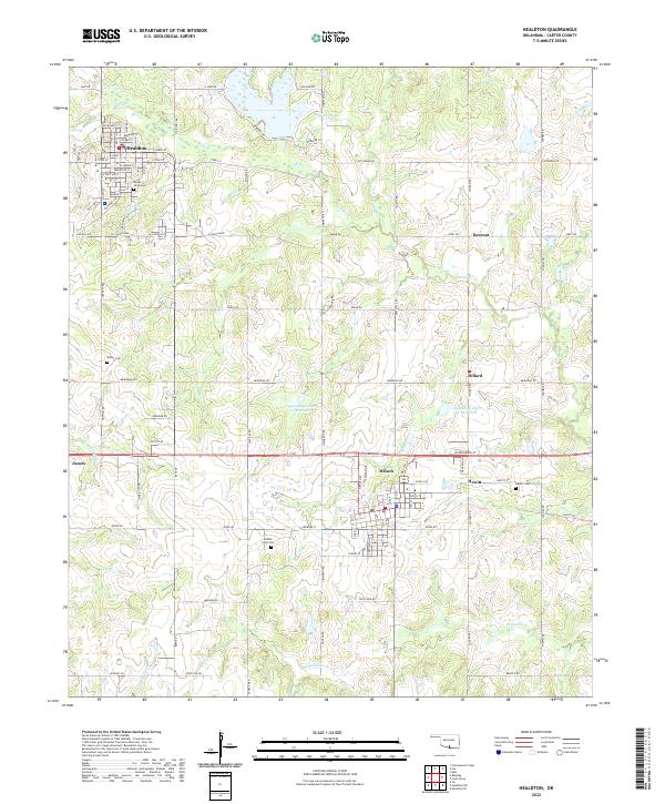
2022 Map of Healdton
USGS Topo · Published 2022About this map
The town of Healdton serves as a primary hub in this southern Oklahoma landscape, where the grid of city streets like E Main St and Texas St meets the winding oil-and-water geography of Walnut Cr and Oil Br. This 2022 survey captures the persistent layout of small communities including Wilson, Dillard, and Hewitt, many of which were founded during the oil booms of the early 20th century. Local family history and genealogy can be traced through several well-marked burial grounds, including Mount Olive Cem and the Bomar Point Cem near Zaneis.
Find a feature on this map
100 named features on this map. Tap any name to fly to it.
Don’t see what you’re looking for? This feature index may not catch every label — zoom into the map to look around manually.
Map Details
Editions of this 2022 Healdton Map
This is the sole edition of this map. No revisions or reprints were ever made.
Other maps of this area

1901 · Addington
USGS Topo · 1:125,000

1901 · Ardmore
USGS Topo · 1:125,000

1918 · Ardmore
USGS Topo · 1:125,000

1957 · Ardmore
USGS Topo · 1:250,000

1963 · Ardmore
USGS Topo · 1:250,000

1969 · Healdton
USGS Topo · 1:24,000

1969 · Lone Grove
USGS Topo · 1:24,000
1969 · Healdton SW
USGS Topo · 1:24,000
1969 · Milo
USGS Topo · 1:24,000
1969 · Healdton SE
USGS Topo · 1:24,000